Coastal and Landfast Sea Ice Thickness in Western Ross Sea, Antarctica, from Airborne Electromagnetic Induction in November 2017: Terra Nova Bay
Simple
Identification info
- Date (Creation)
- 2022-11-09T11:05:00
- Date (Publication)
- 2022-11-09T11:05:00
- Citation identifier
- https://doi.org/10.1594/PANGAEA.950400
- Presentation form
- Status
- Completed
- Point of contact - Custodian, Owner, etc
-
Role Organisation Individual Electronic mail address Author Langhorne, Patricia J.
Co-author Haas, Christian.
Co-author Rack, Wolfgang.
Co-author Leonard, Greg H.
Co-author Brett, Gemma Marie.
Co-author Price, Daniel.
Publisher PANGAEA
- Spatial representation type
- Topic category
-
- Oceans
Extent
))
Temporal extent
- Time period
- 2017-11-10T00:00:00 2017-11-10T00:00:00
- Keywords
-
-
TERRA NOVA BAY
-
SUB-ICE PLATLET LAYER
-
ELECTROMAGNETIC INDUCTION
-
EM-BIRD
-
K066A
-
- GCMD Earth Science and Earth Science Services Keywords
-
-
SEA ICE DYNAMICS
-
SEA ICE
-
ICE DEPTH/THICKNESS
-
- GCMD Platform/Sources Keywords
-
-
Air-based Platforms
-
HELICOPTER
-
FIELD SURVEYS
-
Airplane
-
- GCMD Locations Keywords
-
-
ANTARCTICA
-
ROSS SEA
-
- Resource constraints
-
Legal constraints Access constraints Use constraints Constraint application scope This data set conforms to the CC BY Attribution License ( https://creativecommons.org/licenses/by/4.0/ )
License License Dataset
Associated resource
- Association Type
- Cross reference
- Initiative Type
- Project
Associated resource
- Association Type
- Cross reference
- Initiative Type
- Project
- Language
- English
- Character encoding
- UTF8
- Supplemental Information
-
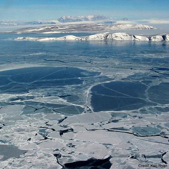
Location Terra Nova Bay
Fast ice data collected 10 Nov 2017
Blank cell indicates that data do not exist at that location.
NB: for level ice column5=column7 and column 6=column8. For rough ice there are no entries in columns 7, 8, & 9.
Distribution Information
- Distribution format
-
Transfer options
- Online resource
-
Name Linkage (URL) Protocol Function Description Pangaea
https://doi.pangaea.de/10.1594/PANGAEA.950400?format=textfile
WWW:DOWNLOAD-1.0-http--download
Download
- Metadata constraints
-
Legal constraints Access constraints Use constraints Constraint application scope This data set conforms to the CC BY Attribution License ( https://creativecommons.org/licenses/by/4.0/ )
License License Metadata
Metadata
- Metadata identifier
- urn:uuid/9096e57a-5d61-45ba-935c-84df2b08424c
- Language
- English
- Character encoding
- anyValidURI
- Metadata Contact
-
Role Organisation Individual Electronic mail address Point of contact Langhorne, Patricia J.
Type of resource
- Resource scope
- Dataset
- Metadata linkage
-
Name Linkage (URL) Protocol Function Description Complete Metadata
- Date info (Revision)
- 2024-05-23T23:03:48
- Date info (Creation)
- 2024-02-29T23:24:29
Metadata standard
- Format name
-
ISO 19115-1
- Edition
-
2018
Overviews
Spatial extent
)))
Provided by