 Metadata Catalogue
maps
Type of resources
Topics
Keywords
Contact for the resource
Provided by
Years
Update frequencies
status
-
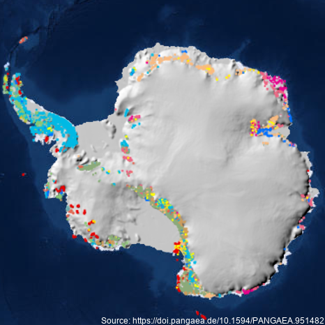
A dataset describing exposed bedrock and surficial geology of Antarctica constructed by the GeoMAP Action Group of SCAR (The Scientific Committee on Antarctic Research) and GNS Science, New Zealand. Legacy geological map data have been captured into a geographic information system (GIS), refining its spatial reliability, harmonising classification, then improving representation of glacial sequences and geomorphology. A total 99,080 polygons have been unified for depicting geology at 1:250,000 scale, but locally there are some areas with higher spatial precision. Geological definition in GeoMAP v.2022-08 is founded on a mixed chronostratigraphic- and lithostratigraphic-based classification. Description of rock and moraine polygons employs international GeoSciML data protocols to provide attribute-rich and queriable data; including bibliographic links to 589 source maps and scientific literature. Data are provided under CC-BY License as zipped ArcGIS geodatabase, QGIS geopackage or GoogleEarth kmz files. GeoMAP is the first detailed geological dataset covering all of Antarctica. GeoMAP depicts 'known geology' of rock exposures rather than 'interpreted' sub-ice features and is suitable for continent-wide perspectives and cross-discipline interrogation. Further details are provided at: Cox, S.C., Smith Lyttle, B., Elkind, S. et al. A continent-wide detailed geological map dataset of Antarctica. Sci Data 10, 250 (2023). https://doi.org/10.1038/s41597-023-02152-9 GET DATA: https://doi.pangaea.de/10.1594/PANGAEA.951482