GNSS Data collected at Priestley Glacier November 2018
Simple
Identification info
- Date (Creation)
- 2021-09-22T00:00:00
- Date (Publication)
- 2021-09-22T00:00:00
- Citation identifier
- https://doi.org/10.1594/PANGAEA.936090
- Presentation form
- Status
- Completed
- Point of contact - Custodian, Owner, etc
-
Role Organisation Individual Electronic mail address Author Drews, Reinhard. reinhard.drews@uni-tuebingen.de Co-author Wild, Christian T. wildch@oregonstate.edu Co-author Marsh, Oliver. olrs@bas.ac.uk Co-author Rack, Wolfgang. wolfgang.rack@canterbury.ac.nz Co-author Ehlers, Todd A. Co-author Neckel, Niklas. Co-author Helm, Veit. Publisher PANGAEA info@pangaea.de
- Spatial representation type
- Topic category
-
- Geoscientific information
Extent
N
S
E
W
))


Temporal extent
- Time period
- 2018-11-01T00:00:00 2018-12-29T12:00:00
- Maintenance and update frequency
- Not planned
- Keywords
-
- PRIESTLEY GLACIER
- INSTALLATION
- K050A
- GCMD Earth Science and Earth Science Services Keywords
-
- GLACIERS
- TIDES
- OCEANS
- GLACIER MOTION/ICE SHEET MOTION
- GCMD Platform/Sources Keywords
-
- Global Positioning System (GPS)
- GCMD Instrument/Sensors Keywords
-
- GPS
- GNSS
- GCMD Locations Keywords
-
- ANTARCTICA
- Resource constraints
-
Legal constraints Access constraints Use constraints Constraint application scope This data set conforms to the CC BY Attribution License (https://creativecommons.org/licenses/by/4.0/) License License Dataset
- Language
- English
- Character encoding
- UTF8
Distribution Information
- Distribution format
-
- Metadata constraints
-
Legal constraints Access constraints Use constraints Constraint application scope This data set conforms to the CC BY Attribution License (https://creativecommons.org/licenses/by/4.0/) License License Metadata
Metadata
- Metadata identifier
- urn:uuid/d5409f49-303f-4b69-b679-9455f3ed07a9
- Language
- English
- Character encoding
- anyValidURI
- Metadata Contact
-
Role Organisation Individual Electronic mail address Point of contact PANGAEA info@pangaea.de
Type of resource
- Resource scope
- Dataset
- Metadata linkage
-
Name Linkage (URL) Protocol Function Description https://doi.org/10.1594/PANGAEA.936090 Complete Metadata
- Date info (Revision)
- 2024-10-07T22:25:27.393Z
- Date info (Creation)
- 2024-04-19T03:35:36
Metadata standard
- Format name
- ISO 19115-1
- Edition
- 2018
Overviews
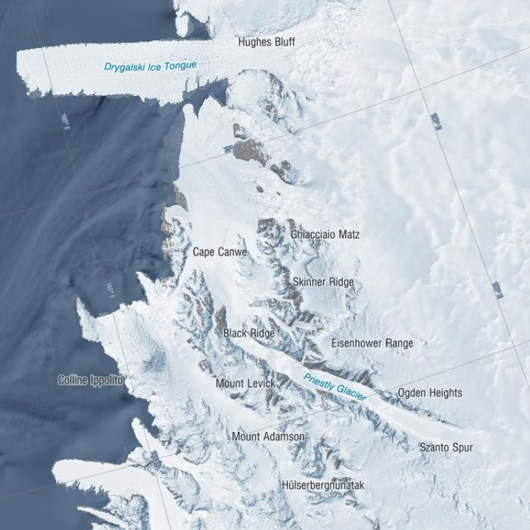
Priestley Glacier
Spatial extent

Provided by

Associated resources
Not available