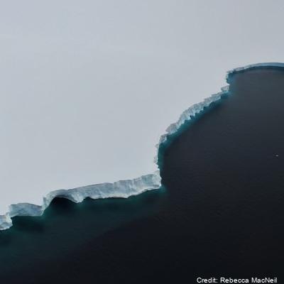
Tide Gauge Data, Cape Roberts, 1990-Present
A tide gauge was installed in November 1990 and has been in near continuous operation since. A 10 minute average of water depth was recorded each hour with hourly averages of wind speed and direction, air temperature and solar radiation. From 2000 the recording frequency was increased from every hour to every 10 minutes. From 2003 data is read every 10 seconds and an average value (from 60 readings) is calculated every 5 minutes and recorded. Barometric pressure was measured as well, starting in 2003, with six barometric pressure readings made between 2 and 3 minutes in the 5-minute interval and averaged and recorded with the tide value. Each year the rise and fall of the sea ice is observed over a 2 - 3 day period during a spring tide using GPS. These measurements are related to a tide gauge bench mark and the sea surface to enable the reliability of the tide gauge to be checked. The tide gauge data is archived by Land Information New Zealand.
Instrument coordinates (-77.0339, 163.1897)
GET DATA: https://sealevel-data.linz.govt.nz/index.html?tidegauge=ROBT
Simple
Identification info
- Date (Creation)
- 2023-08-14T17:11:25
- Date (Publication)
- 2023-08-14T17:14:22
- Presentation form
- Status
- On going
- Point of contact - Custodian, Owner, etc
-
Role Organisation Individual Electronic mail address Author Collett, D. dcollett@linz.govt.nz Co-author Amos, M. mamos@linz.govt.nz Publisher Toitū Te Whenua (LINZ) customersupport@linz.govt.nz
- Spatial representation type
- Topic category
-
- Oceans
Extent
))

Temporal extent
- Time period
- 1990-11-20T00:00:00
- Maintenance and update frequency
- As needed
- Date
- 2023-08-12T00:07:57
- Date type
- Last Update
- Keywords
-
- K150A
- INSTALLATION
- GCMD Platform/Sources Keywords
-
- GROUND STATIONS
- GCMD Instrument/Sensors Keywords
-
- TIDE GAUGES
- GCMD Locations Keywords
-
- ANTARCTICA
- Resource constraints
-
Legal constraints Access constraints Use constraints Constraint application scope This data set conforms to the CC BY Attribution License (https://creativecommons.org/licenses/by/4.0/) License License Dataset
Associated resource
- Association Type
- Cross reference
- Initiative Type
- Program
- Metadata Reference
- Language
- English
- Character encoding
- UTF8
Distribution Information
- Distribution format
-
- Metadata constraints
-
Legal constraints Access constraints Use constraints Constraint application scope This data set conforms to the CC BY Attribution License (https://creativecommons.org/licenses/by/4.0/) License License Metadata
Metadata
- Metadata identifier
- urn:uuid/b5faabfa-a3c2-48f5-9a2c-3ba433ba2c7f
- Language
- English
- Character encoding
- anyValidURI
- Metadata Contact
-
Role Organisation Individual Electronic mail address Point of contact Toitū Te Whenua (LINZ) dcollett@linz.govt.nz
Type of resource
- Resource scope
- Dataset
- Metadata linkage
-
Name Linkage (URL) Protocol Function Description https://sealevel-data.linz.govt.nz/index.html?tidegauge=SCOT Complete Metadata
- Date info (Revision)
- 2024-10-01T03:09:31.697Z
- Date info (Creation)
- 2023-08-11T12:16:06
Metadata standard
- Format name
- ISO 19115-1
- Edition
- 2018
 Metadata Catalogue

