The GeoMAP (v.2022-08) continent-wide detailed geological dataset of Antarctica
Simple
Identification info
- Date (Creation)
- 2023-03-16
- Date (Publication)
- 2023-03-16T00:00:00
- Citation identifier
- https://doi.org/10.1594/PANGAEA.951482
- Presentation form
- Status
- Completed
- Point of contact - Custodian, Owner, etc
-
Role Organisation Individual Electronic mail address Author Cox, Simon Christopher. s.cox@gns.cri.nz Co-author Smith Lyttle, Belinda. Co-author Elkind, Samuel. Co-author Smith Siddoway, Christine S. Co-author Morin, Paul. Co-author Capponi, Giovanni. Co-author Abu-Alam, Tamer. Co-author Ballinger, Matilda. Co-author Kitchener, Brett. Co-author Lelli, Luigi. Co-author Mawson, Jasmine F. Co-author Millikin, Alexie. Co-author Dal Seno, Nicola. Co-author Whitburn, Louis. Co-author White, Tristan. Co-author Burton-Johnson, Alex. Co-author Crispini, Laura. Co-author Elliot, David. Co-author Elvevold, Synnøve. Co-author Goodge, John W. Co-author Halpin, Jacqueline A. Co-author Jacobs, Joachim. Co-author Mikhalsky, Eugene. Co-author Martin, Adam P. Co-author Morgan, Fraser. Co-author Smellie, John. Co-author Scadden, Phil. Co-author Wilson, Gary S. Publisher PANGAEA info@pangaea.de
- Spatial representation type
- Topic category
-
- Geoscientific information
Extent
N
S
E
W
))
N
S
E
W
))
- Maintenance and update frequency
- Not planned
- Keywords
-
- GEOLOGY
- GEOMORPHOLOGY
- GLACIAL DEPOSITS
- MAPPING
- GCMD Earth Science and Earth Science Services Keywords
-
- GLACIAL LANDFORMS
- GEOLOGICAL FEATURES
- GCMD Locations Keywords
-
- ANTARCTICA
- Resource constraints
-
Legal constraints Access constraints Use constraints Constraint application scope This data set conforms to the CC BY Attribution License (https://creativecommons.org/licenses/by/4.0/) License License Dataset
- Language
- English
- Character encoding
- UTF8
Distribution Information
- Distribution format
-
- Reference System Information
-
Reference system type Code Description Projected 3031 WGS 84 / Antarctic Polar Stereographic
- Metadata constraints
-
Legal constraints Access constraints Use constraints Constraint application scope This data set conforms to the CC BY Attribution License (https://creativecommons.org/licenses/by/4.0/) License License Metadata
Metadata
- Metadata identifier
- urn:uuid/add11628-3133-48d3-aff1-943b03347ca0
- Language
- English
- Character encoding
- anyValidURI
- Metadata Contact
-
Role Organisation Individual Electronic mail address Point of contact GNS s.cox@gns.cri.nz
Type of resource
- Resource scope
- Dataset
- Metadata linkage
-
Name Linkage (URL) Protocol Function Description https://doi.org/10.1594/PANGAEA.951482 Complete Metadata
- Date info (Revision)
- 2024-05-20T00:26:09
- Date info (Creation)
- 2024-04-18T02:11:06
Metadata standard
- Format name
- ISO 19115-1
- Edition
- 2018
Overviews
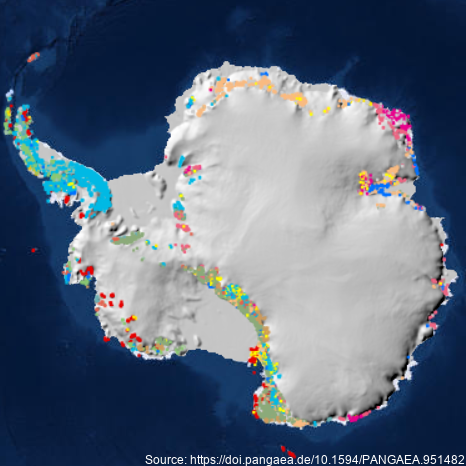
Source: https://doi.pangaea.de/10.1594/PANGAEA.951482
Spatial extent
),POLYGON((160%20-90,160%20-55,40%20-55,40%20-90,160%20-90))))
Provided by

Associated resources
Not available