Borehole Ground Temperature Data at Bull Pass and Marble Point, Southern Victoria Land, Antarctica
Simple
Identification info
- Date (Creation)
- 2023-08-10T16:56:18
- Date (Publication)
- 2023-08-10T16:56:18
- Presentation form
- Status
- On going
- Point of contact - Custodian, Owner, etc
-
Role Organisation Individual Electronic mail address Publisher United States Department of Agriculture
- Spatial representation type
- Topic category
-
- Geoscientific information
Extent
))


Temporal extent
- Time period
- 2005-01-01T00:00:00
- Maintenance and update frequency
- As needed
- Date
- 2023-08-10T16:56:24
- Date type
- Last Update
- GCMD Earth Science and Earth Science Services Keywords
-
-
SURFACE WINDS
-
SOIL MOISTURE
-
WATER VAPOR
-
SOIL TEMPERATURE
-
PERMAFROST
-
ACTIVE LAYER
-
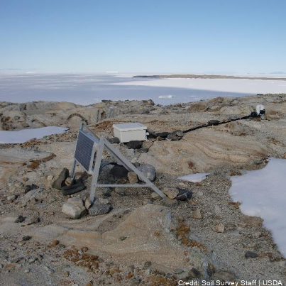
BOREHOLES
-
- GCMD Platform/Sources Keywords
-
-
GROUND STATIONS
-
- GCMD Instrument/Sensors Keywords
-
-
SOIL TEMPERATURE PROBE
-
SOIL MOISTURE PROBE
-
- GCMD Locations Keywords
-
-
ANTARCTICA
-
- Theme
-
-
MARBLE POINT
-
BULL PASS
-
MCMURDO DRY VALLEYS
-
INSTALLATION
-
K881B
-
- Resource constraints
-
Legal constraints Access constraints Use constraints Constraint application scope This data set conforms to the CC BY-NC Attribution License ( https://creativecommons.org/licenses/by-nc/4.0/ )
License License Dataset
- Language
- English
- Character encoding
- UTF8
Distribution Information
- Distribution format
-
- Metadata constraints
-
Legal constraints Access constraints Use constraints Constraint application scope This data set conforms to the CC BY-NC Attribution License ( https://creativecommons.org/licenses/by-nc/4.0/ )
License License Metadata
Metadata
- Metadata identifier
- urn:uuid/88d77a12-f1ea-44d2-95f7-bdee9c9cd193
- Language
- English
- Character encoding
- anyValidURI
- Metadata Contact
-
Role Organisation Individual Electronic mail address Point of contact Manaaki Whenua Landcare Research
Type of resource
- Resource scope
- Dataset
- Metadata linkage
-
Name Linkage (URL) Protocol Function Description https://www.nrcs.usda.gov/resources/data-and-reports/soil-climate-research-stations
Complete Metadata
- Date info (Revision)
- 2026-03-31T21:42:54.246Z
- Date info (Creation)
- 2024-06-04T20:28:28
Metadata standard
- Format name
-
ISO 19115-1
- Edition
-
2018
Overviews
Spatial extent

Provided by